Sample Pages Preview

 Preface
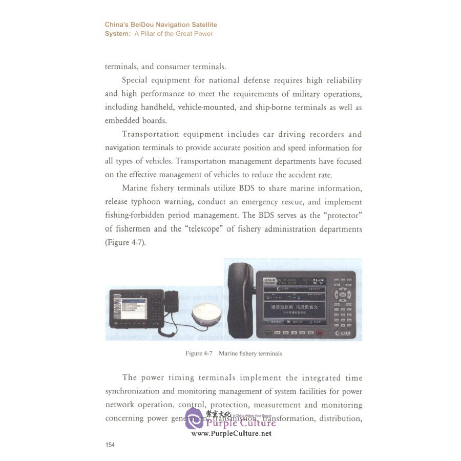
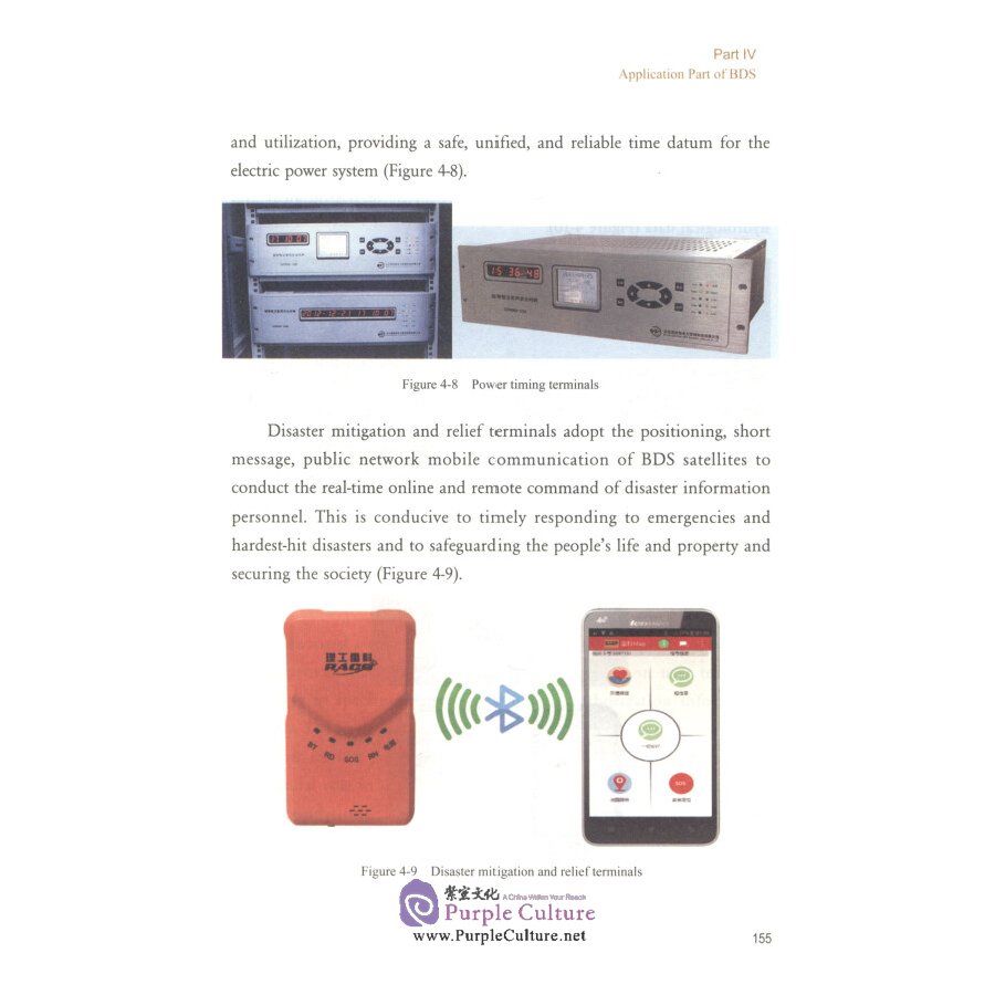
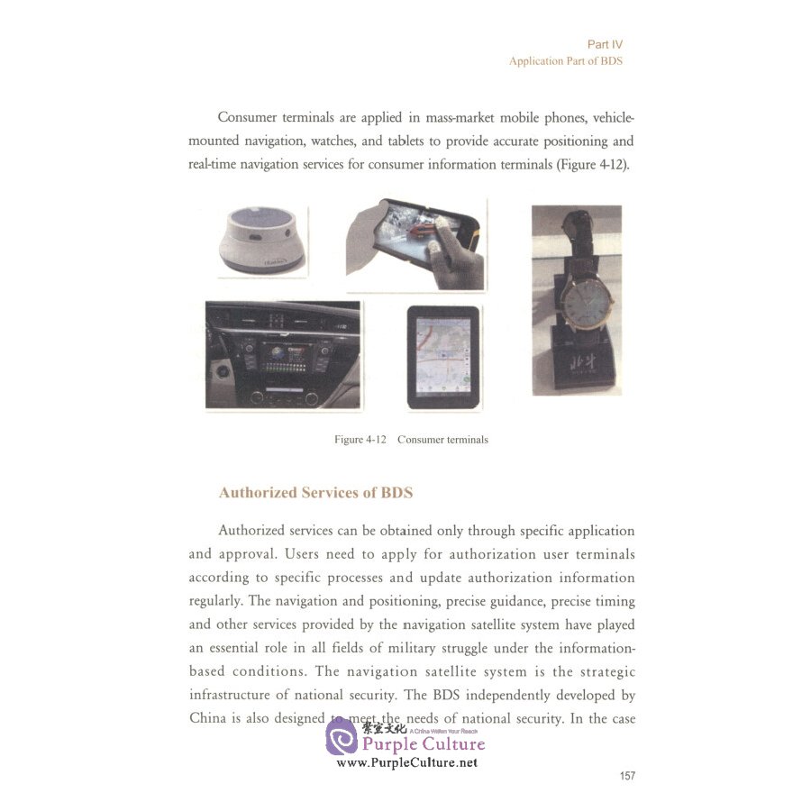
The BeiDou Navigation Satellite System (COMPASS/BDS) has been independently constructed and operated by China with an eye to the needs of the country's national security and economic and social development. As an important space infrastructure of national significance, the BDS provides global users with all-time, all-weather and high-accuracy po-sitioning, navigation, timing, and short message services.
The development of BDS is advancing steadily according to the three-step development strategy. The construction of BeiDou-l system and BDS-2 has been completed successively, which were put into operation in December 2003 and December 2012, respectively. The development of BDS global system (BDS-3) is being implemented in an orderly and well-planned manner. During the development of BDS, it has further developed and enriched the theories and methods of the navigation satellite system, thanks to its unique constellation design and bi-model services,as well as open, compatible and interoperable concepts. Such efforts have captured the world's attention, expanding the influence with more applications. However, over the years, some people still have an unclear understanding of BDS due to insufFicient publicity and knowledge popularization. To allow people caring about, understanding and supporting the development of BDS to have a deep understanding of BDS and utilize more related applications, we compiled China's BeiDou Navigation Satellite System: A Pillar of the Great Power and China's BeiDou Navigation Satellite System:A Navigator for the World. The two books aim to introduce the basic con-cept, principle, and composition of BDS in a comprehensive and detailed way and scientifically interpret the key technologies, theoretical methods and application examples of BDS. I hope the two books can help people to answer questions, clarify concepts, provide authoritative interpretation,and let more people further understand and support the BDS, so as to promote the wide application of BDS in China's national defense, economic and social development, and various industries. Let BeiDou, the star of China, amaze the world and benefit the people with China's national wisdom and technological civilization.
China's BeiDou Navigation Satellite System: A Piiar of the Great Power is divided into four parts respectively compiled by Prof. Yang Li of the Institute of Navigation and Space Target Engineering of the Information Engineering University of the People's Liberation Army (PLA), Research Fellow Zhang Chuanding, Senior Engineer Chen Jinping and Senior Engineer He Haibo of Beijing Satellite Navigation Center. The book was compiled finally by Prof. Yang Li. Academicians and experts such as Sun Jiadong, the first chief engineer of BeiDou Navigation Satellite System, were invited to review and finalize this book. This book has received strong support from the competent authorities of China's satellite navigation and positioning applications. Comrades Ma Dong, Zhao Yong, and Tang Jing of China National Administration of GNSS and Applications (CNAGA) have reviewed the book and put forward valuable suggestions. We hereby express

")


![Tai Chi [Hardcover]](/bmz_cache/f/f3438fcaaa2ac6d27df627412f000ec3.image.130x164.jpg "Tai Chi [Hardcover]")
 Version (with CD + DVD)")
")
")
")
 (with DVD & CD)")


 (Chinese-English)")
")
 (Chinese-English)")